Tag: maps
-
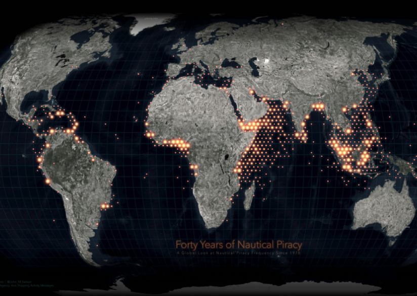
Map: Visualizing 40 Years of Nautical Piracy
February 08: A web map visualization of piracy incidents from 1978 to October 2018 has been made, both as an aggregation layer of 50,000 square kilometre hexagonal cells at broad […]

February 08: A web map visualization of piracy incidents from 1978 to October 2018 has been made, both as an aggregation layer of 50,000 square kilometre hexagonal cells at broad […]
Copyright © 2024 Maritime Security Review. All Rights Reserved. Theme by ![]()